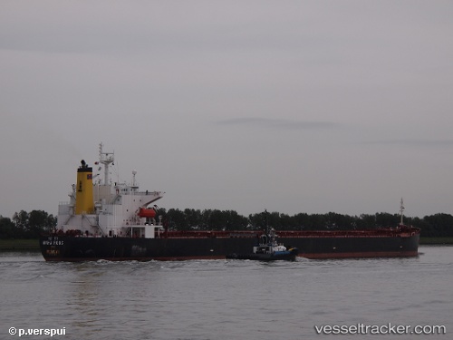
Maha Roos
Current StatusWhere is the vessel?
Maha Roos is currently in 35 nm W of Okha, based on AIS data received about 14h ago.
Latest AIS update:
Current position: 22.39513° N, 68.45803° E (35 nm W of Okha)
Average speed (last 7 days): Loading…
Average speed (last 30 days): Loading…
Vessel profile: Maha Roos is a Bulk Carrier with dimensions 32m x 225m.
This page combines live AIS, route history, probable destination signals, nearby traffic, and port activity for practical vessel monitoring.
The current position of vessel Maha Roos is 22.39513 lat / 68.45803 lng. Updated: 2026-05-21 02:38:28 UTCNearest reference points:
- 13 nm W of Måndvi
- 49 nm S of Positra
- 54 nm S of Positra
Details:
Live Vessel Maha Roos Analytics (details, animations, etc.)
Recent AIS points (UTC):
2026-05-20 22:08:28 UTC · 22.39553, 68.46248 · SOG 0.1 kn · COG 269°2026-05-20 23:23:28 UTC · 22.39435, 68.46208 · SOG 0.2 kn · COG 296°
2026-05-21 02:08:28 UTC · 22.39473, 68.45826 · SOG 0.1 kn · COG 22°
2026-05-21 02:38:28 UTC · 22.39513, 68.45803 · SOG 0.1 kn · COG 39°