 S.ARAS
Current Status
Where is the vessel?
S.ARAS is currently in 175 nm SW of Port Etienne, based on AIS data received about 14h ago.
Latest AIS update:
Current position: 19.18166° N, 19.73681° W (175 nm SW of Port Etienne)
Average speed (last 7 days): Loading…
Average speed (last 30 days): Loading…
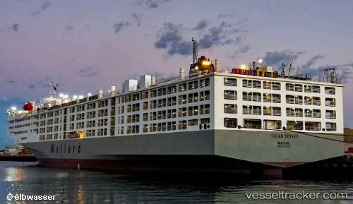
Vessel profile: S.ARAS is a Livestock Carrier with dimensions m x m.
This page combines live AIS, route history, probable destination signals, nearby traffic, and port activity for practical vessel monitoring.
The current position of vessel S.ARAS is 19.18166 lat / -19.73681 lng. Updated: 2026-05-21 16:24:04 UTCNearest reference points:
- 176 nm NE of Ilha do Sal
- 119 nm W of Nouakchott
- 108 nm SW of Port Etienne
Currently sailing under the flag of Marshall Islands ![]()
Details:
Live Vessel S.ARAS Analytics (details, animations, etc.)
Recent AIS points (UTC):
2026-05-21 12:25:58 UTC · 20.31169, -19.16625 · SOG 19.2 kn · COG 206°2026-05-21 13:10:44 UTC · 20.09667, -19.27500 · SOG 19 kn · COG -1°
2026-05-21 13:37:46 UTC · 19.97019, -19.33818 · SOG 18.8 kn · COG 202°
2026-05-21 16:24:04 UTC · 19.18166, -19.73681 · SOG 18.3 kn · COG 204°