 OCEANICASUB VII
Current Status
Where is the vessel?
OCEANICASUB VII is currently in 40 nm E of Açu Pt/São João da Barra, based on AIS data received about 15h ago.
Latest AIS update:
Current position: 21.89122° S, 40.28783° W (40 nm E of Açu Pt/São João da Barra)
Average speed (last 7 days): Loading…
Average speed (last 30 days): Loading…
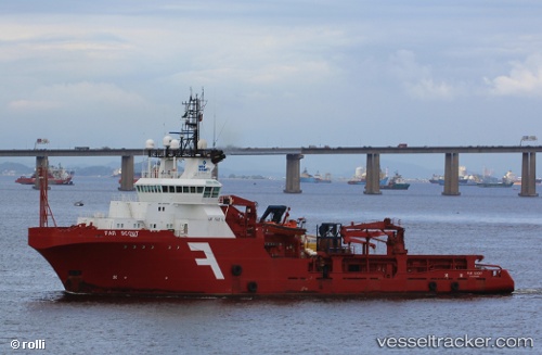
Vessel profile: OCEANICASUB VII is a Anchor Handling Vessel with dimensions m x m.
This page combines live AIS, route history, probable destination signals, nearby traffic, and port activity for practical vessel monitoring.
The current position of vessel OCEANICASUB VII is -21.89122 lat / -40.28783 lng. Updated: 2026-05-22 03:55:16 UTCNearest reference points:
- Near Capixaba FPSO
- Near PORTO DO ACU
- Near Fluminense FPSO
Details:
Live Vessel OCEANICASUB VII Analytics (details, animations, etc.)
Recent AIS points (UTC):
2026-05-22 01:02:57 UTC · -21.92353, -39.85766 · SOG 8.4 kn · COG 260°2026-05-22 02:16:32 UTC · -21.91263, -40.04404 · SOG 8.2 kn · COG 265°
2026-05-22 03:25:03 UTC · -21.90105, -40.21304 · SOG 8.6 kn · COG 269°
2026-05-22 03:55:16 UTC · -21.89122, -40.28783 · SOG 8.4 kn · COG 264°