 GOODAL
Current Status
Where is the vessel?
GOODAL is currently in 391 nm SE of Gaalkacyo, based on AIS data received about 14h ago.
Latest AIS update:
Current position: 2.59167° N, 52.43333° E (391 nm SE of Gaalkacyo)
Average speed (last 7 days): Loading…
Average speed (last 30 days): Loading…
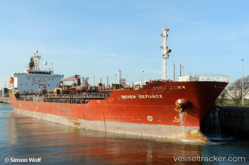
Vessel profile: GOODAL is a Oil/Chemical Tanker with dimensions m x m.
This page combines live AIS, route history, probable destination signals, nearby traffic, and port activity for practical vessel monitoring.
The current position of vessel GOODAL is 2.59167 lat / 52.43333 lng. Updated: 2026-05-19 14:08:01 UTCNearest reference points:
- Open sea, approx. 412 nm off the nearest listed port
- Open sea, approx. 414 nm off the nearest listed port
- Open sea, approx. 416 nm off the nearest listed port
Currently sailing under the flag of Bahamas ![]()
Details:
Live Vessel GOODAL Analytics (details, animations, etc.)
Recent AIS points (UTC):
2026-05-19 10:20:02 UTC · 3.11667, 52.79667 · SOG 10 kn · COG -1°2026-05-19 12:05:08 UTC · 2.87500, 52.63167 · SOG 9 kn · COG -1°
2026-05-19 13:44:00 UTC · 2.64746, 52.47339 · SOG 10.1 kn · COG 215°
2026-05-19 14:08:01 UTC · 2.59167, 52.43333 · SOG 10 kn · COG -1°