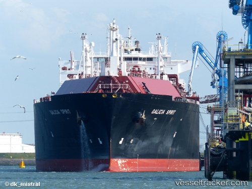
 SEAPEAK GALICIA
Current Status
Where is the vessel?
SEAPEAK GALICIA is currently in 131 nm W of Yof, based on AIS data received about 14h ago.
Latest AIS update:
Current position: 14.90679° N, 19.71481° W (131 nm W of Yof)
Average speed (last 7 days): Loading…
Average speed (last 30 days): Loading…
Vessel profile: SEAPEAK GALICIA is a Lng Tanker with dimensions m x m.
This page combines live AIS, route history, probable destination signals, nearby traffic, and port activity for practical vessel monitoring.
The current position of vessel SEAPEAK GALICIA is 14.90679 lat / -19.71481 lng. Updated: 2026-05-19 12:26:11 UTCNearest reference points:
- Near Dakar
- Near Rufisque
- 100 nm NW of Saint Louis
Currently sailing under the flag of Bahamas ![]()
Details:
Live Vessel SEAPEAK GALICIA Analytics (details, animations, etc.)
Recent AIS points (UTC):
2026-05-19 07:52:21 UTC · 13.72845, -19.71726 · SOG 15.6 kn · COG 0°2026-05-19 10:15:39 UTC · 14.34461, -19.72136 · SOG 15.3 kn · COG 358°
2026-05-19 11:00:23 UTC · 14.53738, -19.71886 · SOG 15.4 kn · COG 0°
2026-05-19 12:26:11 UTC · 14.90679, -19.71481 · SOG 15.4 kn · COG 1°