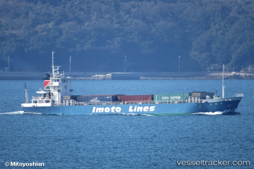
 HIROAN
Current Status
Where is the vessel?
HIROAN is currently in Near Ôshima, Nagasaki, based on AIS data received about 14h ago.
Latest AIS update:
Current position: 33.11568° N, 129.62315° E (Near Ôshima, Nagasaki)
Average speed (last 7 days): Loading…
Average speed (last 30 days): Loading…
Vessel profile: HIROAN is a Cargo with dimensions m x m.
This page combines live AIS, route history, probable destination signals, nearby traffic, and port activity for practical vessel monitoring.
The current position of vessel HIROAN is 33.11568 lat / 129.62315 lng. Updated: 2026-05-19 14:18:51 UTCNearest reference points:
- Near MATSUSHIMA
- Near TSUKINOKAWA
- Near Fukushima, Nagasaki
Currently sailing under the flag of Panama ![]()
Details:
Live Vessel HIROAN Analytics (details, animations, etc.)
Recent AIS points (UTC):
2026-05-19 11:12:52 UTC · 33.11545, 129.62376 · SOG 0 kn · COG 348°2026-05-19 11:24:53 UTC · 33.11548, 129.62329 · SOG 0 kn · COG 26°
2026-05-19 13:04:25 UTC · 33.11500, 129.62334 · SOG 0 kn · COG -1°
2026-05-19 14:18:51 UTC · 33.11568, 129.62315 · SOG 0 kn · COG 47°