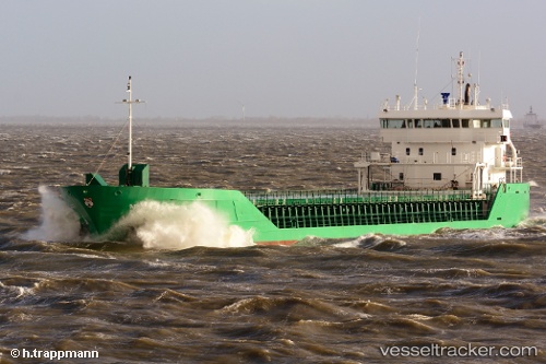
 FAMITA
Current Status
Where is the vessel?
FAMITA is currently in Near Fevik, based on AIS data received about 15h ago.
Latest AIS update:
Current position: 58.31391° N, 8.79291° E (Near Fevik)
Average speed (last 7 days): Loading…
Average speed (last 30 days): Loading…
Vessel profile: FAMITA is a General Cargo with dimensions m x m.
This page combines live AIS, route history, probable destination signals, nearby traffic, and port activity for practical vessel monitoring.
The current position of vessel FAMITA is 58.31391 lat / 8.79291 lng. Updated: 2026-05-19 22:48:51 UTCNearest reference points:
- 28 nm NW of Lokken
- 27 nm N of HANSTHOLM
- Near Kristiansand
Currently sailing under the flag of Bahamas ![]()
Details:
Live Vessel FAMITA Analytics (details, animations, etc.)
Recent AIS points (UTC):
2026-05-19 19:28:31 UTC · 58.01722, 8.15199 · SOG 8.3 kn · COG 76°2026-05-19 19:32:21 UTC · 58.01940, 8.16864 · SOG 8.6 kn · COG 75°
2026-05-19 21:40:31 UTC · 58.20220, 8.59084 · SOG 8.2 kn · COG 46°
2026-05-19 22:48:51 UTC · 58.31391, 8.79291 · SOG 8.2 kn · COG 38°