 PROS BELINDA
Current Status
Where is the vessel?
PROS BELINDA is currently in 257 nm E of Tan Cang Qui Nhon, based on AIS data received about 15h ago.
Latest AIS update:
Current position: 12.81833° N, 114.12333° E (257 nm E of Tan Cang Qui Nhon)
Average speed (last 7 days): Loading…
Average speed (last 30 days): Loading…
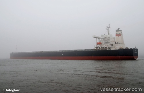
Vessel profile: PROS BELINDA is a Bulk Carrier with dimensions m x m.
This page combines live AIS, route history, probable destination signals, nearby traffic, and port activity for practical vessel monitoring.
The current position of vessel PROS BELINDA is 12.81833 lat / 114.12333 lng. Updated: 2026-05-20 07:52:09 UTCNearest reference points:
- 237 nm W of Tindalo Oil Field
- 232 nm E of Tan Cang Qui Nhon
- 226 nm SE of Tan Cang Qui Nhon
Currently sailing under the flag of Panama ![]()
Details:
Live Vessel PROS BELINDA Analytics (details, animations, etc.)
Recent AIS points (UTC):
2026-05-20 04:37:09 UTC · 12.34833, 113.75167 · SOG 10 kn · COG -1°2026-05-20 05:46:13 UTC · 12.51167, 113.88833 · SOG 10 kn · COG -1°
2026-05-20 07:28:09 UTC · 12.76333, 114.07333 · SOG 11 kn · COG -1°
2026-05-20 07:52:09 UTC · 12.81833, 114.12333 · SOG 11 kn · COG -1°