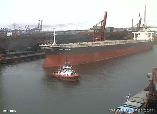
.
Vessel photo of Sunny Boffa (IMO 9253090) vesseltracker.com

Sunny Boffa

Vessel type: Bulk Carrier | IMO: 9253090 | MMSI: MMSI: 636018299
Call sign: 9VYQ3 | Dimensions: 45 m x 289 m
Current Status

Where is the vessel?

Sunny Boffa is currently in 147 nm SE of Port Saint John's, based on AIS data received about 14h ago.

Latest AIS update:

Current position: 33.13327° S, 31.82580° E (147 nm SE of Port Saint John's)

Average speed (last 7 days): Loading…

Average speed (last 30 days): Loading…

Vessel profile: Sunny Boffa is a Bulk Carrier with dimensions 45m x 289m.

This page combines live AIS, route history, probable destination signals, nearby traffic, and port activity for practical vessel monitoring.

The current position of vessel Sunny Boffa is -33.13327 lat / 31.82580 lng. Updated: 2026-05-18 07:14:44 UTC
More recent position available: 1 h 28 min ago
Free positions are delayed by 14 hours.

We recommend registering. If you register, paid vessel access will be saved in your profile. Guest access works only through a personal link.

Nearest reference points:
  • 125 nm SE of Port Edward
  • 181 nm SE of Hibberdene
  • 23 nm E of Port Saint John's
Details:

Live Vessel Sunny Boffa Analytics (details, animations, etc.)


Recent AIS points (UTC):
2026-05-18 03:54:50 UTC · -33.26531, 31.17488 · SOG 10.6 kn · COG 78°
2026-05-18 04:12:39 UTC · -33.25256, 31.23536 · SOG 10.5 kn · COG 78°
2026-05-18 05:45:24 UTC · -33.18990, 31.54262 · SOG 10.2 kn · COG 79°
2026-05-18 07:14:44 UTC · -33.13327, 31.82580 · SOG 9.7 kn · COG 81°

UTC: --
Start: -- Track timeline (UTC) End: --
Encountered: --


Link to the map:


Find another ship

Sunny_Boffa (636018299) last ports (portcalls and passsages)

Port de Boké | 2025-09-14 11:50:10
Port de Boké | 2025-09-10 02:04:40
Sebang | 2025-08-06 10:24:55
BUKOM ISLAND | 2025-08-04 08:47:58
BATU AMPAR | 2025-08-04 07:41:06
TANAH MERAH | 2025-08-03 22:06:40
PENGERANG | 2025-08-03 19:23:33
Longkou | 2025-07-22 08:32:13
Longkou | 2025-07-18 07:29:39
PENGERANG | 2025-07-05 23:24:02
TANAH MERAH | 2025-07-05 08:34:30
BATU AMPAR | 2025-07-05 07:11:05
PULAU SAMBU | 2025-07-05 06:04:53
Cape Of Good Hope | 2025-04-26 03:42:41
PULAU SAMBU | 2025-04-06 17:24:51
TEKONG ISLAND | 2025-04-06 06:11:17
TANAH MERAH | 2025-04-06 04:38:51
PENGERANG | 2025-04-06 02:57:10
Yen-Tai | 2025-03-25 06:14:30
Yen-Tai | 2025-03-21 05:27:24
SURALAYA | 2025-03-08 16:20:09
BAKAUHENI | 2025-03-08 14:43:14
PULAU SAMBU | 2024-12-18 01:27:58
BATU AMPAR | 2024-12-18 00:49:31
TANAH MERAH | 2024-12-17 09:52:45
PENGERANG | 2024-12-17 08:14:51
Yen-Tai | 2024-12-04 07:22:25
CHANGXINDAO | 2024-11-29 15:15:05
CHANGXINDAO | 2024-11-25 14:39:07
CHANGXINDAO | 2024-11-21 14:32:15
CHANGXINDAO | 2024-11-17 14:26:39
CHANGXINDAO | 2024-11-13 13:14:20
CHANGXINDAO | 2024-11-07 17:02:50
CHANGXINDAO | 2024-11-03 16:34:35
Sebang | 2024-07-02 21:49:17
Sambu | 2024-06-30 19:59:15
Yen-Tai | 2024-06-17 13:15:10
Lianyungang | 2024-06-10 10:59:46
Singapore | 2024-03-11 07:20:23
Singapore | 2023-11-20 04:25:00
Longkou | 2023-11-08 09:20:44
Longkou | 2023-11-04 08:43:34
Longkou | 2023-07-17 05:14:01
Yen-Tai | 2023-07-13 22:21:04
Selat Sunda | 2023-06-27 13:30:53
Sebang | 2023-04-16 05:10:35
Singapore | 2023-04-14 02:21:39
Yen-Tai | 2022-12-20 11:33:54
Qingdao | 2022-07-27 10:09:53
Yen-Tai | 2022-06-30 13:56:37
Singapore | 2022-04-08 18:08:19
Yen-Tai | 2022-02-20 06:47:38
Singapore | 2021-12-02 00:55:04
Sambu | 2021-12-02 00:25:39