Sunny Link
Current StatusWhere is the vessel?
Sunny Link is currently in 37 nm NW of Krueng Geukueh, based on AIS data received about 14h ago.
Latest AIS update:
Current position: 5.79871° N, 96.75355° E (37 nm NW of Krueng Geukueh)
Average speed (last 7 days): Loading…
Average speed (last 30 days): Loading…
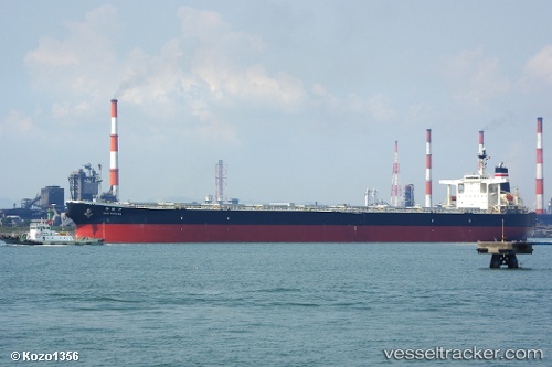
Vessel profile: Sunny Link is a Bulk Carrier with dimensions 45m x 289m.
This page combines live AIS, route history, probable destination signals, nearby traffic, and port activity for practical vessel monitoring.
The current position of vessel Sunny Link is 5.79871 lat / 96.75355 lng. Updated: 2026-05-20 22:43:53 UTCNearest reference points:
- 45 nm NE of Krueng Geukueh
- 34 nm N of Langsa Venture FPSO
- 45 nm N of Langsa Venture FPSO
Details:
Live Vessel Sunny Link Analytics (details, animations, etc.)
Recent AIS points (UTC):
2026-05-20 19:12:24 UTC · 5.63058, 97.47060 · SOG 12.3 kn · COG 281°2026-05-20 19:12:24 UTC · 5.63058, 97.47060 · SOG 12.3 kn · COG 281°
2026-05-20 22:19:34 UTC · 5.77312, 96.83991 · SOG 13.2 kn · COG 290°
2026-05-20 22:43:53 UTC · 5.79871, 96.75355 · SOG 13.2 kn · COG 296°