 S Cape
Current Status
Where is the vessel?
S Cape is currently in 33 nm N of Gross Koris, based on AIS data received about 15h ago.
Latest AIS update:
Current position: 14.21397° N, 52.18181° E (33 nm N of Gross Koris)
Average speed (last 7 days): Loading…
Average speed (last 30 days): Loading…
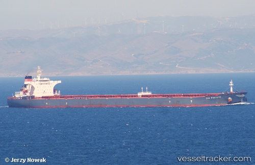
Vessel profile: S Cape is a Bulk Carrier with dimensions 289m x 45m.
This page combines live AIS, route history, probable destination signals, nearby traffic, and port activity for practical vessel monitoring.
The current position of vessel S Cape is 14.21397 lat / 52.18181 lng. Updated: 2026-05-21 10:57:55 UTCNearest reference points:
- 110 nm NE of Gross Koris
- 106 nm S of Port Raysut
- 103 nm S of Port Raysut
Currently sailing under the flag of Marshall Is ![]()
S Cape built in 2003 year
Deadweight:
175526 tDetails:
Live Vessel S Cape Analytics (details, animations, etc.)
Recent AIS points (UTC):
2026-05-21 09:24:45 UTC · 14.29898, 52.46167 · SOG 11 kn · COG 257°2026-05-21 09:24:45 UTC · 14.29898, 52.46167 · SOG 11 kn · COG 257°
2026-05-21 10:57:55 UTC · 14.21397, 52.18181 · SOG 11.1 kn · COG 260°
2026-05-21 10:57:55 UTC · 14.21397, 52.18181 · SOG 11.1 kn · COG 260°