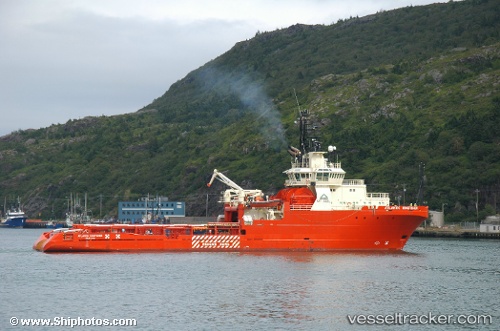
 ATLANTIC KINGFISHER
Current Status
Where is the vessel?
ATLANTIC KINGFISHER is currently in 16 nm N of Cidade de Angra dos Reis FPSO, based on AIS data received about 15h ago.
Latest AIS update:
Current position: 25.28662° S, 42.73410° W (16 nm N of Cidade de Angra dos Reis FPSO)
Average speed (last 7 days): Loading…
Average speed (last 30 days): Loading…
Vessel profile: ATLANTIC KINGFISHER is a Anchor Handling Vessel with dimensions m x m.
This page combines live AIS, route history, probable destination signals, nearby traffic, and port activity for practical vessel monitoring.
The current position of vessel ATLANTIC KINGFISHER is -25.28662 lat / -42.73410 lng. Updated: 2026-05-19 02:07:02 UTCNearest reference points:
- 34 nm S of Cidade de Angra dos Reis FPSO
- 69 nm NE of Cidade de Angra dos Reis FPSO
- 49 nm S of SEPETIBA
Details:
Live Vessel ATLANTIC KINGFISHER Analytics (details, animations, etc.)
Recent AIS points (UTC):
2026-05-18 22:13:52 UTC · -25.29733, -42.72857 · SOG 0 kn · COG 80°2026-05-19 00:25:01 UTC · -25.29028, -42.73039 · SOG 0.4 kn · COG 145°
2026-05-19 01:55:34 UTC · -25.28627, -42.73374 · SOG 0.4 kn · COG 135°
2026-05-19 02:07:02 UTC · -25.28662, -42.73410 · SOG 0 kn · COG 134°