 MERIOS
Current Status
Where is the vessel?
MERIOS is currently in Near Tuzla Free Zone, based on AIS data received about 14h ago.
Latest AIS update:
Current position: 40.70080° N, 29.20786° E (Near Tuzla Free Zone)
Average speed (last 7 days): Loading…
Average speed (last 30 days): Loading…
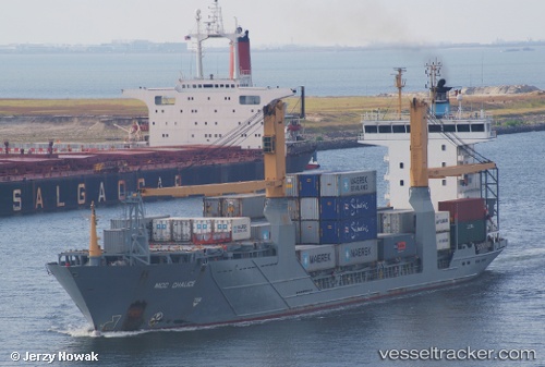
Vessel profile: MERIOS is a Container Ship with dimensions m x m.
This page combines live AIS, route history, probable destination signals, nearby traffic, and port activity for practical vessel monitoring.
The current position of vessel MERIOS is 40.70080 lat / 29.20786 lng. Updated: 2026-05-21 13:06:21 UTCNearest reference points:
- Near TUZLA
- Near Tuzla Free Zone
- Near Maltepe
Currently sailing under the flag of Barbados ![]()
Details:
Live Vessel MERIOS Analytics (details, animations, etc.)
Recent AIS points (UTC):
2026-05-21 09:54:54 UTC · 40.70100, 29.18877 · SOG 0.5 kn · COG 196°2026-05-21 10:54:28 UTC · 40.70068, 29.19406 · SOG 0.6 kn · COG 189°
2026-05-21 11:23:55 UTC · 40.70800, 29.19664 · SOG 1.7 kn · COG 174°
2026-05-21 13:06:21 UTC · 40.70080, 29.20786 · SOG 1.4 kn · COG 165°