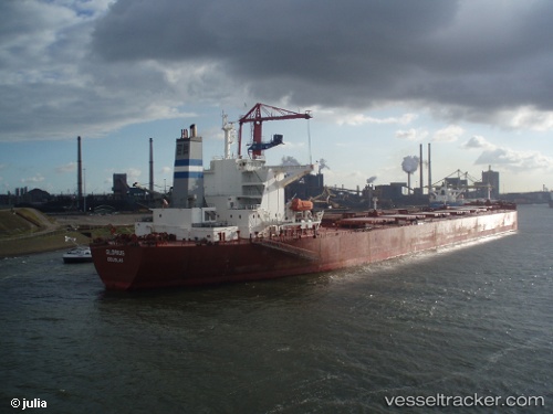
 GLORIUSHIP
Current Status
Where is the vessel?
GLORIUSHIP is currently in 31 nm SE of Rizhao, based on AIS data received about 14h ago.
Latest AIS update:
Current position: 35.06852° N, 120.04014° E (31 nm SE of Rizhao)
Average speed (last 7 days): Loading…
Average speed (last 30 days): Loading…
Vessel profile: GLORIUSHIP is a Bulk Carrier with dimensions 289m x 45m.
This page combines live AIS, route history, probable destination signals, nearby traffic, and port activity for practical vessel monitoring.
The current position of vessel GLORIUSHIP is 35.06852 lat / 120.04014 lng. Updated: 2026-05-20 10:09:45 UTCNearest reference points:
- 23 nm SE of Rizhao
- 30 nm NE of CHENJIAGANG
- 25 nm SE of DONGJIAKOU
Currently sailing under the flag of Marshall Islands ![]()
GLORIUSHIP built in 2004 year
Deadweight:
171320 tDetails:
Live Vessel GLORIUSHIP Analytics (details, animations, etc.)
Recent AIS points (UTC):
2026-05-20 07:45:46 UTC · 35.07206, 120.04351 · SOG 0.2 kn · COG 197°2026-05-20 07:48:46 UTC · 35.07213, 120.04331 · SOG 0.3 kn · COG 193°
2026-05-20 10:02:19 UTC · 35.06844, 120.04027 · SOG 0.1 kn · COG -1°
2026-05-20 10:09:45 UTC · 35.06852, 120.04014 · SOG 0.1 kn · COG 45°