 STAV POWER
Current Status
Where is the vessel?
STAV POWER is currently in Near Monrovia, based on AIS data received about 14h ago.
Latest AIS update:
Current position: 6.35361° N, 10.86568° W (Near Monrovia)
Average speed (last 7 days): Loading…
Average speed (last 30 days): Loading…
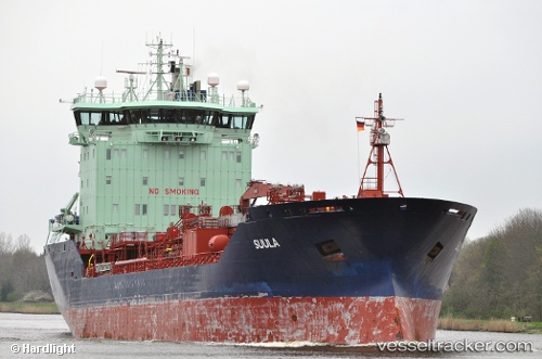
Vessel profile: STAV POWER is a Oil/Chemical Tanker with dimensions m x m.
This page combines live AIS, route history, probable destination signals, nearby traffic, and port activity for practical vessel monitoring.
The current position of vessel STAV POWER is 6.35361 lat / -10.86568 lng. Updated: 2026-05-22 16:28:59 UTCNearest reference points:
- 15 nm SW of Buchanan
- 110 nm SW of River Cess
- Near Kissy
Currently sailing under the flag of Portugal ![]()
Details:
Live Vessel STAV POWER Analytics (details, animations, etc.)
Recent AIS points (UTC):
2026-05-22 13:56:06 UTC · 6.35346, -10.86573 · SOG 0 kn · COG 174°2026-05-22 14:20:11 UTC · 6.35348, -10.86562 · SOG 0 kn · COG 179°
2026-05-22 16:11:10 UTC · 6.35357, -10.86571 · SOG 0 kn · COG 178°
2026-05-22 16:28:59 UTC · 6.35361, -10.86568 · SOG 0.1 kn · COG 178°