 vesseltracker.com
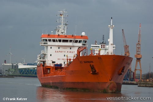
Key Marmara
Current StatusWhere is the vessel?
Key Marmara is currently in 11 nm NW of Visby, based on AIS data received less than 1h ago.
Latest AIS update:
Current position: 57.80282° N, 18.14972° E (11 nm NW of Visby)
Average speed (last 7 days): Loading…
Average speed (last 30 days): Loading…
Vessel profile: Key Marmara is a Chemical Oil Products Tanker with dimensions 17m x 105m.
This page combines live AIS, route history, probable destination signals, nearby traffic, and port activity for practical vessel monitoring.
The current position of vessel Key Marmara is 57.80282 lat / 18.14972 lng. Updated: 2026-05-13 09:48:42 UTCNearest reference points:
- Near Stora Vika
- Near SODERTALJE
- Near Segeltorp
Details:
Live Vessel Key Marmara Analytics (details, animations, etc.)
Recent AIS points (UTC):
2026-05-13 03:55:42 UTC · 56.66181, 17.19226 · SOG 13 kn · COG 18°2026-05-13 04:07:24 UTC · 56.70183, 17.21654 · SOG 13.2 kn · COG 19°
2026-05-13 05:44:03 UTC · 57.02759, 17.43095 · SOG 13 kn · COG 19°
2026-05-13 09:48:42 UTC · 57.80282, 18.14972 · SOG 12.9 kn · COG 27°