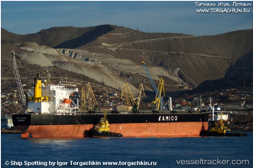
 TAURUS
Current Status
Where is the vessel?
TAURUS is currently in 33 nm NW of BIZERTE, based on AIS data received about 14h ago.
Latest AIS update:
Current position: 37.71301° N, 9.45729° E (33 nm NW of BIZERTE)
Average speed (last 7 days): Loading…
Average speed (last 30 days): Loading…
Vessel profile: TAURUS is a Bulk Carrier with dimensions m x m.
This page combines live AIS, route history, probable destination signals, nearby traffic, and port activity for practical vessel monitoring.
The current position of vessel TAURUS is 37.71301 lat / 9.45729 lng. Updated: 2026-05-22 02:09:48 UTCNearest reference points:
- 33 nm SE of Setubal
- 35 nm S of Setubal
- Near Le Kram
Currently sailing under the flag of Marshall Islands ![]()
Details:
Live Vessel TAURUS Analytics (details, animations, etc.)
Recent AIS points (UTC):
2026-05-21 21:50:38 UTC · 37.59467, 10.53100 · SOG 11.3 kn · COG 281°2026-05-21 21:50:38 UTC · 37.59467, 10.53100 · SOG 11.3 kn · COG 281°
2026-05-22 01:10:06 UTC · 37.68873, 9.71200 · SOG 12.3 kn · COG 271°
2026-05-22 02:09:48 UTC · 37.71301, 9.45729 · SOG 12 kn · COG 269°