 ROSE 25
Current Status
Where is the vessel?
ROSE 25 is currently in 10 nm NE of SAO LUIS, based on AIS data received about 14h ago.
Latest AIS update:
Current position: 0.12713° N, 0.12006° E (10 nm NE of SAO LUIS)
Average speed (last 7 days): Loading…
Average speed (last 30 days): Loading…
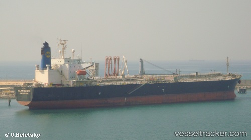
Vessel profile: ROSE 25 is a Oil Products Tanker with dimensions m x m.
This page combines live AIS, route history, probable destination signals, nearby traffic, and port activity for practical vessel monitoring.
The current position of vessel ROSE 25 is 0.12713 lat / 0.12006 lng. Updated: 2026-05-21 14:56:07 UTCNearest reference points:
- Near SAO LUIS
- Near Porsuk
- 66 nm N of SAO LUIS
Currently sailing under the flag of Palau ![]()
Details:
Live Vessel ROSE 25 Analytics (details, animations, etc.)
Recent AIS points (UTC):
2026-05-21 14:56:07 UTC · 0.12713, 0.12006 · SOG 1.4 kn · COG 119°2026-05-21 14:56:07 UTC · 0.12713, 0.12006 · SOG 1.4 kn · COG 119°
2026-05-21 14:56:07 UTC · 0.12713, 0.12006 · SOG 1.4 kn · COG 119°
2026-05-21 14:56:07 UTC · 0.12713, 0.12006 · SOG 1.4 kn · COG 119°