 GREEN POWER
Current Status
Where is the vessel?
GREEN POWER is currently in 174 nm NW of Mutineer, based on AIS data received about 16h ago.
Latest AIS update:
Current position: 17.41180° S, 114.26245° E (174 nm NW of Mutineer)
Average speed (last 7 days): Loading…
Average speed (last 30 days): Loading…
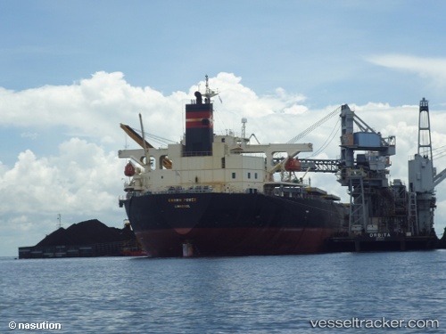
Vessel profile: GREEN POWER is a Bulk Carrier with dimensions m x m.
This page combines live AIS, route history, probable destination signals, nearby traffic, and port activity for practical vessel monitoring.
The current position of vessel GREEN POWER is -17.41180 lat / 114.26245 lng. Updated: 2026-05-19 07:27:25 UTCCurrently sailing under the flag of Panama ![]()
Details:
Live Vessel GREEN POWER Analytics (details, animations, etc.)
Recent AIS points (UTC):
2026-05-19 03:52:24 UTC · -16.78348, 114.36778 · SOG 11 kn · COG 199°2026-05-19 05:29:25 UTC · -17.06273, 114.26668 · SOG 10.7 kn · COG 169°
2026-05-19 07:12:04 UTC · -17.36917, 114.28730 · SOG 11.4 kn · COG 204°
2026-05-19 07:27:25 UTC · -17.41180, 114.26245 · SOG 11.2 kn · COG 210°