 PARAS
PARAS
Current Status
Where is the vessel?
PARAS is currently in Open sea, approx. 455 nm off the nearest listed port, based on AIS data received about 15h ago.
Latest AIS update:
Current position: 4.55310° S, 6.08652° W (Open sea, approx. 455 nm off the nearest listed port)
Average speed (last 7 days): Loading…
Average speed (last 30 days): Loading…
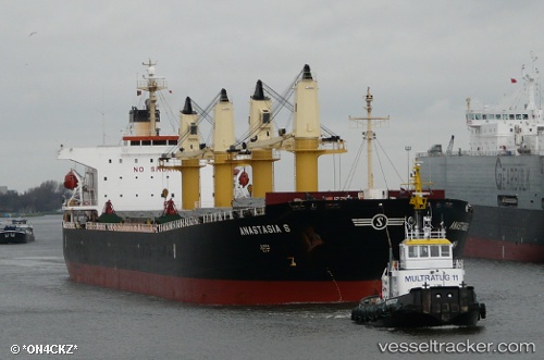
Vessel profile: PARAS is a Bulk Carrier with dimensions 32m x 190m.
This page combines live AIS, route history, probable destination signals, nearby traffic, and port activity for practical vessel monitoring.
The current position of vessel PARAS is -4.55310 lat / -6.08652 lng. Updated: 2026-05-18 18:01:17 UTCNearest reference points:
- Open sea, approx. 455 nm off the nearest listed port
- Open sea, approx. 453 nm off the nearest listed port
- Open sea, approx. 454 nm off the nearest listed port
Currently sailing under the flag of Marshall Islands ![]()
PARAS built in 2004 year
Deadweight:
52808 tDetails:
Live Vessel PARAS Analytics (details, animations, etc.)
Recent AIS points (UTC):
2026-05-18 13:56:45 UTC · -5.18067, -5.60678 · SOG 11.5 kn · COG 327°2026-05-18 16:17:57 UTC · -4.81522, -5.88370 · SOG 11.6 kn · COG 326°
2026-05-18 16:24:57 UTC · -4.79715, -5.89747 · SOG 11.6 kn · COG 326°
2026-05-18 18:01:17 UTC · -4.55310, -6.08652 · SOG 11.6 kn · COG 328°