 ROSALIND
Current Status
Where is the vessel?
ROSALIND is currently in Near Brighton, based on AIS data received about 15h ago.
Latest AIS update:
Current position: 10.33492° N, 61.58354° W (Near Brighton)
Average speed (last 7 days): Loading…
Average speed (last 30 days): Loading…
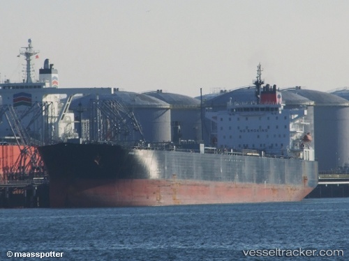
Vessel profile: ROSALIND is a Crude Oil Tanker with dimensions m x m.
This page combines live AIS, route history, probable destination signals, nearby traffic, and port activity for practical vessel monitoring.
The current position of vessel ROSALIND is 10.33492 lat / -61.58354 lng. Updated: 2026-05-23 07:36:49 UTCNearest reference points:
- Near POINT LISAS
- Near Carenage
- Near Caroni
Currently sailing under the flag of Guinea-Bissau ![]()
Details:
Live Vessel ROSALIND Analytics (details, animations, etc.)
Recent AIS points (UTC):
2026-05-23 04:51:50 UTC · 10.33532, -61.58252 · SOG 0.1 kn · COG 186°2026-05-23 06:21:50 UTC · 10.33545, -61.58322 · SOG 0.2 kn · COG 159°
2026-05-23 07:06:55 UTC · 10.33500, -61.58333 · SOG 0 kn · COG -1°
2026-05-23 07:36:49 UTC · 10.33492, -61.58354 · SOG 0 kn · COG 137°