 vesseltracker.com
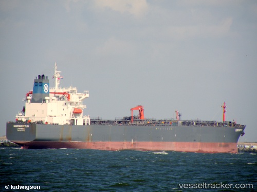
 HAPPY CAMPER
Current Status
Where is the vessel?
HAPPY CAMPER is currently in 16 nm NW of Hulaylah Terminal, based on AIS data received about 1d ago.
Latest AIS update:
Current position: 26.13676° N, 55.68143° E (16 nm NW of Hulaylah Terminal)
Average speed (last 7 days): Loading…
Average speed (last 30 days): Loading…
Vessel profile: HAPPY CAMPER is a Oil Products Tanker with dimensions m x m.
This page combines live AIS, route history, probable destination signals, nearby traffic, and port activity for practical vessel monitoring.
The current position of vessel HAPPY CAMPER is 26.13676 lat / 55.68143 lng. Updated: 2026-05-17 11:15:08 UTCNearest reference points:
- 13 nm NW of Hulaylah Terminal
- 20 nm NW of Hulaylah Terminal
- Near Hulaylah Terminal
Currently sailing under the flag of Barbados ![]()
Details:
Live Vessel HAPPY CAMPER Analytics (details, animations, etc.)
Recent AIS points (UTC):
2026-05-17 11:15:08 UTC · 26.13676, 55.68143 · SOG 3.3 kn · COG 65°2026-05-17 11:15:08 UTC · 26.13676, 55.68143 · SOG 3.3 kn · COG 65°
2026-05-17 11:15:08 UTC · 26.13676, 55.68143 · SOG 3.3 kn · COG 65°
2026-05-17 11:15:08 UTC · 26.13676, 55.68143 · SOG 3.3 kn · COG 65°