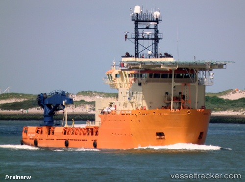
 GEOQUIP SAENTIS
Current Status
Where is the vessel?
GEOQUIP SAENTIS is currently in Near Tema, based on AIS data received about 16h ago.
Latest AIS update:
Current position: 5.58767° N, 0.03526° E (Near Tema)
Average speed (last 7 days): Loading…
Average speed (last 30 days): Loading…
Vessel profile: GEOQUIP SAENTIS is a Multi Purpose Offshore Vessel with dimensions m x m.
This page combines live AIS, route history, probable destination signals, nearby traffic, and port activity for practical vessel monitoring.
The current position of vessel GEOQUIP SAENTIS is 5.58767 lat / 0.03526 lng. Updated: 2026-05-21 22:24:48 UTCNearest reference points:
- Near Ablogamé
- Near Sekondi
- Near Takoradi
Details:
Live Vessel GEOQUIP SAENTIS Analytics (details, animations, etc.)
Recent AIS points (UTC):
2026-05-21 19:50:47 UTC · 5.58779, 0.03514 · SOG 0.1 kn · COG 215°2026-05-21 19:55:58 UTC · 5.58784, 0.03510 · SOG 0.2 kn · COG 220°
2026-05-21 22:06:44 UTC · 5.58782, 0.03518 · SOG 0.3 kn · COG 212°
2026-05-21 22:24:48 UTC · 5.58767, 0.03526 · SOG 0.3 kn · COG 229°