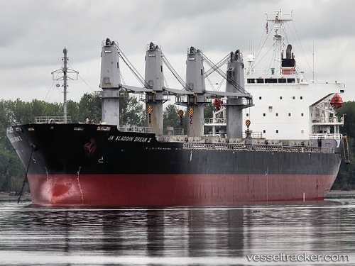
 DREAM
DREAM
Current Status
Where is the vessel?
DREAM is currently in Near Mersin, based on AIS data received about 15h ago.
Latest AIS update:
Current position: 36.70425° N, 34.60532° E (Near Mersin)
Average speed (last 7 days): Loading…
Average speed (last 30 days): Loading…
Vessel profile: DREAM is a Bulk Carrier with dimensions m x m.
This page combines live AIS, route history, probable destination signals, nearby traffic, and port activity for practical vessel monitoring.
The current position of vessel DREAM is 36.70425 lat / 34.60532 lng. Updated: 2026-05-21 08:13:43 UTCNearest reference points:
- Near Mersin
- Near Mersin-Free Zone
- Near YUMURTALIC
Currently sailing under the flag of Saint Kitts and Nevis ![]()
Details:
Live Vessel DREAM Analytics (details, animations, etc.)
Recent AIS points (UTC):
2026-05-21 04:36:23 UTC · 36.70395, 34.60532 · SOG 0 kn · COG 75°2026-05-21 05:17:15 UTC · 36.70407, 34.60540 · SOG 0 kn · COG 75°
2026-05-21 07:14:26 UTC · 36.70413, 34.60527 · SOG 0 kn · COG 82°
2026-05-21 08:13:43 UTC · 36.70425, 34.60532 · SOG 0 kn · COG 85°