 vesseltracker.com
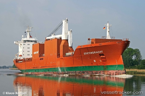
 Statengracht
Current Status
Where is the vessel?
Statengracht is currently in 196 nm SW of Jonesville, based on AIS data received about 14h ago.
Latest AIS update:
Current position: 37.21941° N, 56.19734° W (196 nm SW of Jonesville)
Average speed (last 7 days): Loading…
Average speed (last 30 days): Loading…
Vessel profile: Statengracht is a Multi Purpose Carrier with dimensions 172m x 25m.
This page combines live AIS, route history, probable destination signals, nearby traffic, and port activity for practical vessel monitoring.
The current position of vessel Statengracht is 37.21941 lat / -56.19734 lng. Updated: 2026-05-18 01:59:26 UTCNearest reference points:
- 153 nm S of Jonesville
Currently sailing under the flag of Netherlands ![]()
Statengracht built in 2004 year
Deadweight:
21250 tDetails:
Live Vessel Statengracht Analytics (details, animations, etc.)
Recent AIS points (UTC):
2026-05-17 22:08:05 UTC · 37.15797, -55.02764 · SOG 14.8 kn · COG 275°2026-05-18 00:24:19 UTC · 37.20257, -55.71689 · SOG 14.7 kn · COG 275°
2026-05-18 01:16:24 UTC · 37.20941, -55.98256 · SOG 14.5 kn · COG 275°
2026-05-18 01:59:26 UTC · 37.21941, -56.19734 · SOG 14.3 kn · COG 275°