 vesseltracker.com
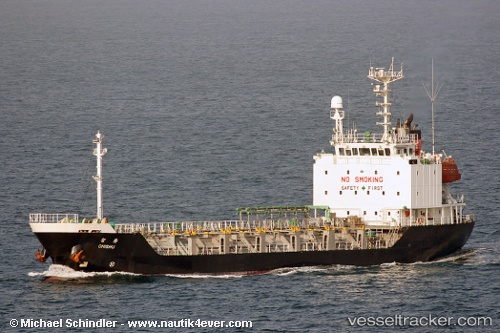
 CHARIS
Current Status
Where is the vessel?
CHARIS is currently in Near Pohang, based on AIS data received about 14h ago.
Latest AIS update:
Current position: 36.02553° N, 129.41376° E (Near Pohang)
Average speed (last 7 days): Loading…
Average speed (last 30 days): Loading…
Vessel profile: CHARIS is a Tanker with dimensions m x m.
This page combines live AIS, route history, probable destination signals, nearby traffic, and port activity for practical vessel monitoring.
The current position of vessel CHARIS is 36.02553 lat / 129.41376 lng. Updated: 2026-05-18 03:26:06 UTCNearest reference points:
- Near Guryongpo
- 19 nm NE of Sinhang/Pohang
- Near Ilsan
Currently sailing under the flag of South Korea ![]()
Details:
Live Vessel CHARIS Analytics (details, animations, etc.)
Recent AIS points (UTC):
2026-05-17 23:44:07 UTC · 36.04848, 129.44662 · SOG 0 kn · COG 224°2026-05-18 01:41:16 UTC · 36.04778, 129.44698 · SOG 0.1 kn · COG 280°
2026-05-18 01:42:26 UTC · 36.04777, 129.44696 · SOG 0 kn · COG 281°
2026-05-18 03:26:06 UTC · 36.02553, 129.41376 · SOG 4.8 kn · COG 286°