 YUG
YUG
Current Status
Where is the vessel?
YUG is currently in 68 nm SE of Xianlang, based on AIS data received about 15h ago.
Latest AIS update:
Current position: 35.19378° N, 121.21308° E (68 nm SE of Xianlang)
Average speed (last 7 days): Loading…
Average speed (last 30 days): Loading…
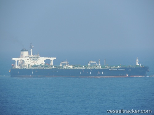
Vessel profile: YUG is a Tanker with dimensions m x m.
This page combines live AIS, route history, probable destination signals, nearby traffic, and port activity for practical vessel monitoring.
The current position of vessel YUG is 35.19378 lat / 121.21308 lng. Updated: 2026-05-22 07:00:27 UTCNearest reference points:
- 71 nm SE of Nudao
- 62 nm NE of CHENJIAGANG
- 81 nm E of CHENJIAGANG
Currently sailing under the flag of Comoros ![]()
Details:
Live Vessel YUG Analytics (details, animations, etc.)
Recent AIS points (UTC):
2026-05-22 03:22:53 UTC · 35.19159, 121.20581 · SOG 0.1 kn · COG -1°2026-05-22 04:54:30 UTC · 35.19093, 121.21165 · SOG 0.2 kn · COG -1°
2026-05-22 06:24:52 UTC · 35.19327, 121.21323 · SOG 0 kn · COG 260°
2026-05-22 07:00:27 UTC · 35.19378, 121.21308 · SOG 0 kn · COG 251°