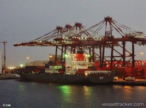
 Limari
Current Status
Where is the vessel?
Limari is currently in 22 nm NW of La Poterie-Cap-d'Antifer, based on AIS data received about 15h ago.
Latest AIS update:
Current position: 49.91169° N, 0.26148° W (22 nm NW of La Poterie-Cap-d'Antifer)
Average speed (last 7 days): Loading…
Average speed (last 30 days): Loading…
Vessel profile: Limari is a Container Ship with dimensions 269m x 269m.
This page combines live AIS, route history, probable destination signals, nearby traffic, and port activity for practical vessel monitoring.
The current position of vessel Limari is 49.91169 lat / -0.26148 lng. Updated: 2026-05-22 04:26:23 UTCNearest reference points:
- 27 nm S of Seaford
- 23 nm S of Ferring
- Near Le Havre
Currently sailing under the flag of Bermuda ![]()
Limari built in 2005 year
Deadweight:
52683 tDetails:
Live Vessel Limari Analytics (details, animations, etc.)
Recent AIS points (UTC):
2026-05-22 01:21:54 UTC · 49.92800, -0.21182 · SOG 1.8 kn · COG 49°2026-05-22 02:35:24 UTC · 49.89725, -0.23598 · SOG 0.2 kn · COG 167°
2026-05-22 03:58:33 UTC · 49.90567, -0.25081 · SOG 1.1 kn · COG 226°
2026-05-22 04:26:23 UTC · 49.91169, -0.26148 · SOG 1.3 kn · COG 236°