 VICTORY ARI
Current Status
Where is the vessel?
VICTORY ARI is currently in 16 nm SW of AMERI, based on AIS data received about 1d ago.
Latest AIS update:
Current position: 28.35457° N, 50.83602° E (16 nm SW of AMERI)
Average speed (last 7 days): Loading…
Average speed (last 30 days): Loading…
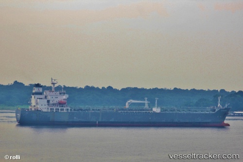
Vessel profile: VICTORY ARI is a Oil/Chemical Tanker with dimensions m x m.
This page combines live AIS, route history, probable destination signals, nearby traffic, and port activity for practical vessel monitoring.
The current position of vessel VICTORY ARI is 28.35457 lat / 50.83602 lng. Updated: 2026-05-18 17:54:26 UTCNearest reference points:
- Near Bushehr
- 44 nm NE of Ras Al Khair
- 41 nm S of Soroosh (Cyrus) Terminal
Currently sailing under the flag of Antigua and Barbuda ![]()
Details:
Live Vessel VICTORY ARI Analytics (details, animations, etc.)
Recent AIS points (UTC):
2026-05-18 17:54:26 UTC · 28.35457, 50.83602 · SOG 9 kn · COG 330°2026-05-18 17:54:26 UTC · 28.35457, 50.83602 · SOG 9 kn · COG 330°
2026-05-18 17:54:26 UTC · 28.35457, 50.83602 · SOG 9 kn · COG 330°
2026-05-18 17:54:26 UTC · 28.35457, 50.83602 · SOG 9 kn · COG 330°