 STILGAR
Current Status
Where is the vessel?
STILGAR is currently in 13 nm NE of Viinistu Sadam, based on AIS data received about 14h ago.
Latest AIS update:
Current position: 59.83601° N, 25.94179° E (13 nm NE of Viinistu Sadam)
Average speed (last 7 days): Loading…
Average speed (last 30 days): Loading…
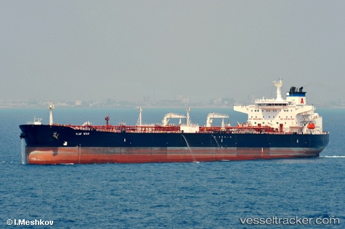
Vessel profile: STILGAR is a Crude Oil Tanker with dimensions m x m.
This page combines live AIS, route history, probable destination signals, nearby traffic, and port activity for practical vessel monitoring.
The current position of vessel STILGAR is 59.83601 lat / 25.94179 lng. Updated: 2026-05-21 08:14:47 UTCNearest reference points:
- 13 nm N of Viinistu Sadam
- Near Vessölandet
- Near Vuosaari (Nordsjö)
Currently sailing under the flag of Sierra Leone ![]()
Details:
Live Vessel STILGAR Analytics (details, animations, etc.)
Recent AIS points (UTC):
2026-05-21 04:32:46 UTC · 59.83574, 25.94184 · SOG 0 kn · COG 271°2026-05-21 05:20:47 UTC · 59.83533, 25.94168 · SOG 0 kn · COG 285°
2026-05-21 07:17:46 UTC · 59.83713, 25.94071 · SOG 0 kn · COG 226°
2026-05-21 08:14:47 UTC · 59.83601, 25.94179 · SOG 0 kn · COG 262°