 NIOVI
NIOVI
Current Status
Where is the vessel?
NIOVI is currently in 207 nm SW of Moho Bilondo, based on AIS data received about 14h ago.
Latest AIS update:
Current position: 8.02398° S, 7.49509° E (207 nm SW of Moho Bilondo)
Average speed (last 7 days): Loading…
Average speed (last 30 days): Loading…
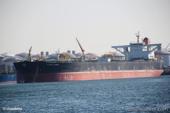
Vessel profile: NIOVI is a Crude Oil Tanker with dimensions 333m x 333m.
This page combines live AIS, route history, probable destination signals, nearby traffic, and port activity for practical vessel monitoring.
The current position of vessel NIOVI is -8.02398 lat / 7.49509 lng. Updated: 2026-05-22 23:26:58 UTCNearest reference points:
- Open sea, approx. 401 nm off the nearest listed port
- Open sea, approx. 402 nm off the nearest listed port
- Open sea, approx. 404 nm off the nearest listed port
Currently sailing under the flag of Panama ![]()
NIOVI built in 2005 year
Deadweight:
309164 tDetails:
Live Vessel NIOVI Analytics (details, animations, etc.)
Recent AIS points (UTC):
2026-05-22 20:00:42 UTC · -7.48894, 7.46942 · SOG 14 kn · COG 0°2026-05-22 21:41:08 UTC · -7.66853, 7.47804 · SOG 14 kn · COG 0°
2026-05-22 23:07:34 UTC · -7.94505, 7.49130 · SOG 14 kn · COG 0°
2026-05-22 23:26:58 UTC · -8.02398, 7.49509 · SOG 14 kn · COG 0°