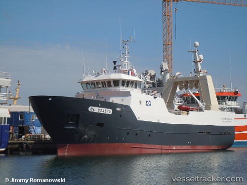
 Cap Saint Georges
Current Status
Where is the vessel?
Cap Saint Georges is currently in 24 nm N of North Ronaldsay Apt, based on AIS data received about 15h ago.
Latest AIS update:
Current position: 59.75736° N, 2.57526° W (24 nm N of North Ronaldsay Apt)
Average speed (last 7 days): Loading…
Average speed (last 30 days): Loading…
Vessel profile: Cap Saint Georges is a Fishing Vessel with dimensions 44m x 10m.
This page combines live AIS, route history, probable destination signals, nearby traffic, and port activity for practical vessel monitoring.
The current position of vessel Cap Saint Georges is 59.75736 lat / -2.57526 lng. Updated: 2026-05-20 17:34:39 UTCNearest reference points:
- Near Tingwall
- 36 nm NW of Ham Voe, Foula
- 32 nm NW of Eshaness
Currently sailing under the flag of France ![]()
Details:
Live Vessel Cap Saint Georges Analytics (details, animations, etc.)
Recent AIS points (UTC):
2026-05-20 13:22:01 UTC · 60.46807, -3.18428 · SOG 10.2 kn · COG 150°2026-05-20 13:35:57 UTC · 60.42916, -3.14664 · SOG 11.2 kn · COG 150°
2026-05-20 16:59:48 UTC · 59.84495, -2.66987 · SOG 10.6 kn · COG 146°
2026-05-20 17:34:39 UTC · 59.75736, -2.57526 · SOG 10.2 kn · COG 136°