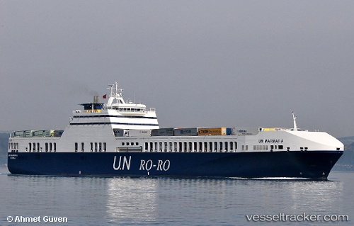
 Un Marmara
Current Status
Where is the vessel?
Un Marmara is currently in 62 nm SW of Matera, based on AIS data received about 14h ago.
Latest AIS update:
Current position: 39.85686° N, 12.77184° E (62 nm SW of Matera)
Average speed (last 7 days): Loading…
Average speed (last 30 days): Loading…
Vessel profile: Un Marmara is a Ro Ro Cargo Ship with dimensions 193m x 26m.
This page combines live AIS, route history, probable destination signals, nearby traffic, and port activity for practical vessel monitoring.
The current position of vessel Un Marmara is 39.85686 lat / 12.77184 lng. Updated: 2026-05-22 04:00:53 UTCNearest reference points:
- 16 nm S of Matera
- Near ANZIO
- Near Gaeta
Currently sailing under the flag of Turkey ![]()
Un Marmara built in 2005 year
Deadweight:
9481 tDetails:
Live Vessel Un Marmara Analytics (details, animations, etc.)
Recent AIS points (UTC):
2026-05-21 22:10:59 UTC · 38.89075, 14.82826 · SOG 18.7 kn · COG 301°2026-05-22 01:27:33 UTC · 39.43050, 13.67120 · SOG 19.5 kn · COG 302°
2026-05-22 02:10:02 UTC · 39.54888, 13.41706 · SOG 19.3 kn · COG 302°
2026-05-22 04:00:53 UTC · 39.85686, 12.77184 · SOG 19.4 kn · COG 301°