 ASTERIA LUNA
Current Status
Where is the vessel?
ASTERIA LUNA is currently in 27 nm S of Arjasa, based on AIS data received about 14h ago.
Latest AIS update:
Current position: 7.28455° S, 115.12850° E (27 nm S of Arjasa)
Average speed (last 7 days): Loading…
Average speed (last 30 days): Loading…
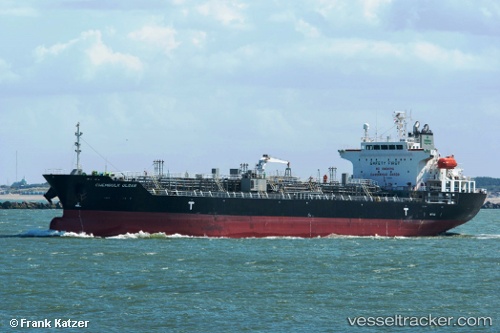
Vessel profile: ASTERIA LUNA is a Oil/Chemical Tanker with dimensions m x m.
This page combines live AIS, route history, probable destination signals, nearby traffic, and port activity for practical vessel monitoring.
The current position of vessel ASTERIA LUNA is -7.28455 lat / 115.12850 lng. Updated: 2026-05-19 04:02:52 UTCNearest reference points:
- 29 nm N of MANGGIS
- 34 nm N of Arjasa
- 37 nm E of Pagerungan
Currently sailing under the flag of Indonesia ![]()
Details:
Live Vessel ASTERIA LUNA Analytics (details, animations, etc.)
Recent AIS points (UTC):
2026-05-19 00:26:58 UTC · -7.59815, 115.55633 · SOG 9.3 kn · COG 295°2026-05-19 00:26:58 UTC · -7.59815, 115.55633 · SOG 9.3 kn · COG 295°
2026-05-19 00:26:58 UTC · -7.59815, 115.55633 · SOG 9.3 kn · COG 295°
2026-05-19 04:02:52 UTC · -7.28455, 115.12850 · SOG 8.5 kn · COG -1°