 Shanghai Highway
Current Status
Where is the vessel?
Shanghai Highway is currently in 156 nm W of Achau, based on AIS data received about 14h ago.
Latest AIS update:
Current position: 49.19753° N, 166.37045° W (156 nm W of Achau)
Average speed (last 7 days): Loading…
Average speed (last 30 days): Loading…
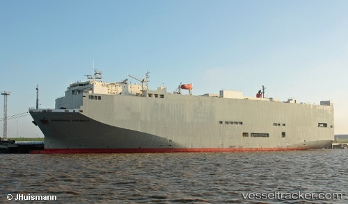
Vessel profile: Shanghai Highway is a Vehicles Carrier with dimensions 180m x 32m.
This page combines live AIS, route history, probable destination signals, nearby traffic, and port activity for practical vessel monitoring.
The current position of vessel Shanghai Highway is 49.19753 lat / -166.37045 lng. Updated: 2026-05-20 22:32:29 UTCCurrently sailing under the flag of Panama ![]()
Shanghai Highway built in 2005 year
Deadweight:
15413 tDetails:
Live Vessel Shanghai Highway Analytics (details, animations, etc.)
Recent AIS points (UTC):
2026-05-20 17:03:06 UTC · 49.40158, -168.43289 · SOG 13.9 kn · COG 106°2026-05-20 17:27:15 UTC · 49.38725, -168.29077 · SOG 14.1 kn · COG 106°
2026-05-20 22:08:10 UTC · 49.21350, -166.52988 · SOG 15.5 kn · COG 101°
2026-05-20 22:32:29 UTC · 49.19753, -166.37045 · SOG 15.4 kn · COG 103°