 Tianjin Highway
Current Status
Where is the vessel?
Tianjin Highway is currently in 350 nm N of Port Mathurin, based on AIS data received about 15h ago.
Latest AIS update:
Current position: 14.11892° S, 65.21365° E (350 nm N of Port Mathurin)
Average speed (last 7 days): Loading…
Average speed (last 30 days): Loading…
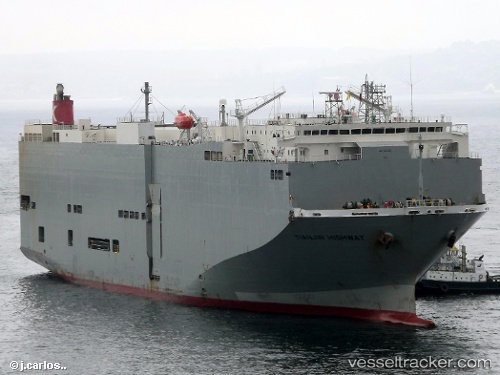
Vessel profile: Tianjin Highway is a Vehicles Carrier with dimensions 180m x 32m.
This page combines live AIS, route history, probable destination signals, nearby traffic, and port activity for practical vessel monitoring.
The current position of vessel Tianjin Highway is -14.11892 lat / 65.21365 lng. Updated: 2026-05-19 11:54:03 UTCNearest reference points:
- 353 nm NE of Port Mathurin
- Open sea, approx. 401 nm off the nearest listed port
- Open sea, approx. 402 nm off the nearest listed port
Currently sailing under the flag of Panama ![]()
Tianjin Highway built in 2005 year
Deadweight:
15461 tDetails:
Live Vessel Tianjin Highway Analytics (details, animations, etc.)
Recent AIS points (UTC):
2026-05-19 07:48:02 UTC · -13.46956, 66.15970 · SOG 16.9 kn · COG 242°2026-05-19 10:07:40 UTC · -13.84061, 65.62160 · SOG 16.3 kn · COG 235°
2026-05-19 10:13:13 UTC · -13.85523, 65.60005 · SOG 16.5 kn · COG 237°
2026-05-19 11:54:03 UTC · -14.11892, 65.21365 · SOG 16.9 kn · COG 236°