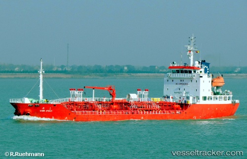
 HARMONY APOLLO
Current Status
Where is the vessel?
HARMONY APOLLO is currently in 13 nm W of Phu Quoc, based on AIS data received about 20h ago.
Latest AIS update:
Current position: 10.18935° N, 103.74551° E (13 nm W of Phu Quoc)
Average speed (last 7 days): Loading…
Average speed (last 30 days): Loading…
Vessel profile: HARMONY APOLLO is a Oil/Chemical Tanker with dimensions m x m.
This page combines live AIS, route history, probable destination signals, nearby traffic, and port activity for practical vessel monitoring.
The current position of vessel HARMONY APOLLO is 10.18935 lat / 103.74551 lng. Updated: 2026-05-21 15:54:05 UTCNearest reference points:
- Near KRONG PREAH SIHANOUK
- 63 nm NW of Dai Hung (STS Load)
- 30 nm E of Dai Hung (STS Load)
Currently sailing under the flag of Bahamas ![]()
Details:
Live Vessel HARMONY APOLLO Analytics (details, animations, etc.)
Recent AIS points (UTC):
2026-05-21 15:54:05 UTC · 10.18935, 103.74551 · SOG 0.1 kn · COG 171°2026-05-21 15:54:05 UTC · 10.18935, 103.74551 · SOG 0.1 kn · COG 171°
2026-05-21 15:54:05 UTC · 10.18935, 103.74551 · SOG 0.1 kn · COG 171°
2026-05-21 15:54:05 UTC · 10.18935, 103.74551 · SOG 0.1 kn · COG 171°