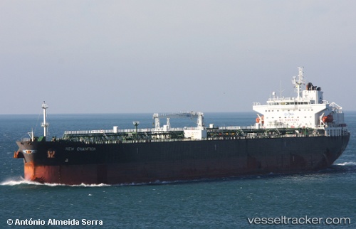
 AL SALMI
Current Status
Where is the vessel?
AL SALMI is currently in 26 nm SE of Wanshan Pt, based on AIS data received about 14h ago.
Latest AIS update:
Current position: 21.55667° N, 113.93500° E (26 nm SE of Wanshan Pt)
Average speed (last 7 days): Loading…
Average speed (last 30 days): Loading…
Vessel profile: AL SALMI is a Crude Oil Tanker with dimensions m x m.
This page combines live AIS, route history, probable destination signals, nearby traffic, and port activity for practical vessel monitoring.
The current position of vessel AL SALMI is 21.55667 lat / 113.93500 lng. Updated: 2026-05-20 16:36:04 UTCNearest reference points:
- 33 nm SE of Wanshan Pt
- 14 nm SE of Wanshan Pt
- 42 nm SE of Wanshan Pt
Currently sailing under the flag of Panama ![]()
Details:
Live Vessel AL SALMI Analytics (details, animations, etc.)
Recent AIS points (UTC):
2026-05-20 13:03:05 UTC · 21.55827, 113.93561 · SOG 0.1 kn · COG 167°2026-05-20 14:29:18 UTC · 21.55667, 113.93500 · SOG 0 kn · COG -1°
2026-05-20 15:56:47 UTC · 21.55667, 113.93500 · SOG 0 kn · COG -1°
2026-05-20 16:36:04 UTC · 21.55667, 113.93500 · SOG 0 kn · COG -1°