 vesseltracker.com
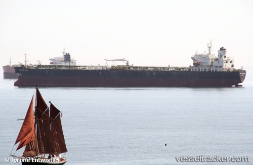
 DESHENG
Current Status
Where is the vessel?
DESHENG is currently in 39 nm E of Claonaig, based on AIS data received about 14h ago.
Latest AIS update:
Current position: 55.85500° N, 6.51833° E (39 nm E of Claonaig)
Average speed (last 7 days): Loading…
Average speed (last 30 days): Loading…
Vessel profile: DESHENG is a Tanker with dimensions m x m.
This page combines live AIS, route history, probable destination signals, nearby traffic, and port activity for practical vessel monitoring.
The current position of vessel DESHENG is 55.85500 lat / 6.51833 lng. Updated: 2026-05-18 05:06:45 UTCNearest reference points:
- 36 nm W of HVIDE SANDE
- Near Blavand
- Near Fanoe
Currently sailing under the flag of Marshall Islands ![]()
Details:
Live Vessel DESHENG Analytics (details, animations, etc.)
Recent AIS points (UTC):
2026-05-18 01:56:41 UTC · 56.42500, 6.99667 · SOG 12 kn · COG -1°2026-05-18 03:30:14 UTC · 56.14333, 6.76667 · SOG 12 kn · COG -1°
2026-05-18 04:48:40 UTC · 55.90833, 6.56500 · SOG 11 kn · COG -1°
2026-05-18 05:06:45 UTC · 55.85500, 6.51833 · SOG 11 kn · COG -1°