 CUMBRIAN
Current Status
Where is the vessel?
CUMBRIAN is currently in 51 nm E of Eforie Sud, based on AIS data received about 14h ago.
Latest AIS update:
Current position: 43.89724° N, 29.79128° E (51 nm E of Eforie Sud)
Average speed (last 7 days): Loading…
Average speed (last 30 days): Loading…
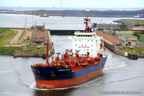
Vessel profile: CUMBRIAN is a Oil/Chemical Tanker with dimensions m x m.
This page combines live AIS, route history, probable destination signals, nearby traffic, and port activity for practical vessel monitoring.
The current position of vessel CUMBRIAN is 43.89724 lat / 29.79128 lng. Updated: 2026-05-21 09:53:06 UTCNearest reference points:
- 20 nm E of Eforie Sud
- 54 nm SE of Sveti Nikola
- 12 nm SE of Sulina (Port et Zone Franche)
Currently sailing under the flag of Barbados ![]()
Details:
Live Vessel CUMBRIAN Analytics (details, animations, etc.)
Recent AIS points (UTC):
2026-05-20 22:26:18 UTC · 41.78919, 29.34993 · SOG 11 kn · COG 3°2026-05-20 22:26:18 UTC · 41.78919, 29.34993 · SOG 11 kn · COG 3°
2026-05-20 22:26:18 UTC · 41.78919, 29.34993 · SOG 11 kn · COG 3°
2026-05-21 09:53:06 UTC · 43.89724, 29.79128 · SOG 11.6 kn · COG 10°