 VIREL
VIREL
Current Status
Where is the vessel?
VIREL is currently in 17 nm W of Villanueva de Lorenzana, based on AIS data received about 14h ago.
Latest AIS update:
Current position: 43.40637° N, 9.66066° W (17 nm W of Villanueva de Lorenzana)
Average speed (last 7 days): Loading…
Average speed (last 30 days): Loading…
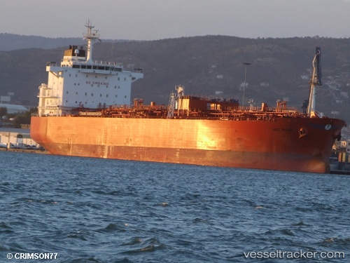
Vessel profile: VIREL is a Oil/Chemical Tanker with dimensions m x m.
This page combines live AIS, route history, probable destination signals, nearby traffic, and port activity for practical vessel monitoring.
The current position of vessel VIREL is 43.40637 lat / -9.66066 lng. Updated: 2026-05-20 11:42:05 UTCNearest reference points:
- 13 nm NE of Villanueva de Lorenzana
- Near Portosin
- 30 nm NW of Meiras-Valdoviño
Currently sailing under the flag of Cameroon ![]()
Details:
Live Vessel VIREL Analytics (details, animations, etc.)
Recent AIS points (UTC):
2026-05-20 07:31:04 UTC · 42.60457, -9.82676 · SOG 11.8 kn · COG 2°2026-05-20 09:54:03 UTC · 43.07063, -9.79422 · SOG 11.6 kn · COG 2°
2026-05-20 10:34:34 UTC · 43.20127, -9.78461 · SOG 11.7 kn · COG 3°
2026-05-20 11:42:05 UTC · 43.40637, -9.66066 · SOG 12 kn · COG 28°