 MARITIM KHATULISTIWA
Current Status
Where is the vessel?
MARITIM KHATULISTIWA is currently in Near Makassar, based on AIS data received about 14h ago.
Latest AIS update:
Current position: 5.11208° S, 119.41078° E (Near Makassar)
Average speed (last 7 days): Loading…
Average speed (last 30 days): Loading…
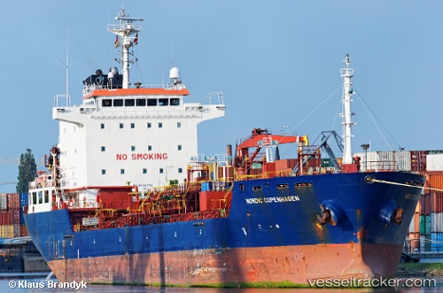
Vessel profile: MARITIM KHATULISTIWA is a Oil/Chemical Tanker with dimensions m x m.
This page combines live AIS, route history, probable destination signals, nearby traffic, and port activity for practical vessel monitoring.
The current position of vessel MARITIM KHATULISTIWA is -5.11208 lat / 119.41078 lng. Updated: 2026-05-20 07:56:17 UTCNearest reference points:
- Near Makassar
- Near Panakukang
- 12 nm W of Panakukang
Currently sailing under the flag of Indonesia ![]()
Details:
Live Vessel MARITIM KHATULISTIWA Analytics (details, animations, etc.)
Recent AIS points (UTC):
2026-05-20 04:54:36 UTC · -5.11208, 119.41082 · SOG 0 kn · COG 269°2026-05-20 06:17:15 UTC · -5.11210, 119.41075 · SOG 0 kn · COG 270°
2026-05-20 07:32:45 UTC · -5.11210, 119.41077 · SOG 0 kn · COG 270°
2026-05-20 07:56:17 UTC · -5.11208, 119.41078 · SOG 0 kn · COG 269°