 vesseltracker.com
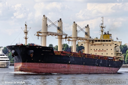
 AK LIZA
Current Status
Where is the vessel?
AK LIZA is currently in 48 nm SE of Dhekelia, based on AIS data received about 14h ago.
Latest AIS update:
Current position: 34.40320° N, 34.42231° E (48 nm SE of Dhekelia)
Average speed (last 7 days): Loading…
Average speed (last 30 days): Loading…
Vessel profile: AK LIZA is a Bulk Carrier with dimensions m x m.
This page combines live AIS, route history, probable destination signals, nearby traffic, and port activity for practical vessel monitoring.
The current position of vessel AK LIZA is 34.40320 lat / 34.42231 lng. Updated: 2026-05-18 02:19:18 UTCNearest reference points:
- 31 nm SE of Vasilikos
- Near Larnaca
- 17 nm S of Vasilikos
Currently sailing under the flag of Barbados ![]()
Details:
Live Vessel AK LIZA Analytics (details, animations, etc.)
Recent AIS points (UTC):
2026-05-17 23:06:08 UTC · 34.23577, 34.01147 · SOG 6.9 kn · COG 63°2026-05-17 23:40:39 UTC · 34.26390, 34.08383 · SOG 6.7 kn · COG 63°
2026-05-18 02:17:48 UTC · 34.40187, 34.41909 · SOG 7.2 kn · COG 64°
2026-05-18 02:19:18 UTC · 34.40320, 34.42231 · SOG 7.2 kn · COG 64°