 vesseltracker.com
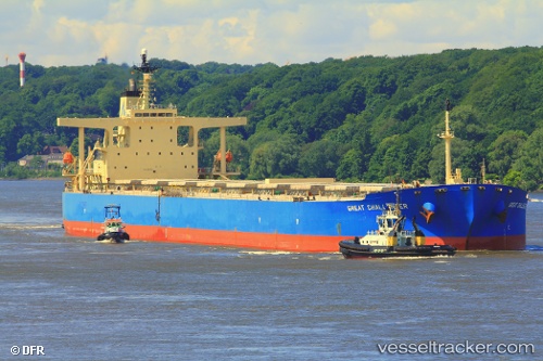
 ASL EARTH
Current Status
Where is the vessel?
ASL EARTH is currently in 38 nm NW of Foinaven, based on AIS data received about 15h ago.
Latest AIS update:
Current position: 60.81672° N, 5.24957° W (38 nm NW of Foinaven)
Average speed (last 7 days): Loading…
Average speed (last 30 days): Loading…
Vessel profile: ASL EARTH is a Bulk Carrier with dimensions 289m x 45m.
This page combines live AIS, route history, probable destination signals, nearby traffic, and port activity for practical vessel monitoring.
The current position of vessel ASL EARTH is 60.81672 lat / -5.24957 lng. Updated: 2026-05-18 09:12:22 UTCNearest reference points:
- 20 nm S of Vágur
- Near FUGLAFJORDUR
- Near VESTMANNA
Currently sailing under the flag of Liberia ![]()
ASL EARTH built in 2005 year
Deadweight:
176279 tDetails:
Live Vessel ASL EARTH Analytics (details, animations, etc.)
Recent AIS points (UTC):
2026-05-18 07:01:28 UTC · 61.08598, -5.01793 · SOG 8 kn · COG 199°2026-05-18 07:01:28 UTC · 61.08598, -5.01793 · SOG 8 kn · COG 199°
2026-05-18 09:12:22 UTC · 60.81672, -5.24957 · SOG 7.9 kn · COG 198°
2026-05-18 09:12:22 UTC · 60.81672, -5.24957 · SOG 7.9 kn · COG 198°