 DENEB
DENEB
Current Status
Where is the vessel?
DENEB is currently in Near Craven Arms, based on AIS data received about 14h ago.
Latest AIS update:
Current position: 52.30617° N, 2.82602° E (Near Craven Arms)
Average speed (last 7 days): Loading…
Average speed (last 30 days): Loading…
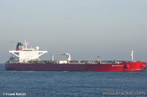
Vessel profile: DENEB is a Crude Oil Tanker with dimensions m x m.
This page combines live AIS, route history, probable destination signals, nearby traffic, and port activity for practical vessel monitoring.
The current position of vessel DENEB is 52.30617 lat / 2.82602 lng. Updated: 2026-05-21 01:45:57 UTCNearest reference points:
- Near Craven Arms
- 21 nm S of Craven Arms
- Near Hunsdon
Currently sailing under the flag of Sierra Leone ![]()
Details:
Live Vessel DENEB Analytics (details, animations, etc.)
Recent AIS points (UTC):
2026-05-20 23:06:25 UTC · 51.94856, 2.68147 · SOG 8.1 kn · COG 359°2026-05-20 23:26:07 UTC · 51.99388, 2.67508 · SOG 8.3 kn · COG 4°
2026-05-21 01:25:55 UTC · 52.26138, 2.79094 · SOG 8.8 kn · COG 21°
2026-05-21 01:45:57 UTC · 52.30617, 2.82602 · SOG 9.1 kn · COG 20°