 MALY
MALY
Current Status
Where is the vessel?
MALY is currently in Near Gamcheon/Busan, based on AIS data received about 14h ago.
Latest AIS update:
Current position: 35.08425° N, 129.00494° E (Near Gamcheon/Busan)
Average speed (last 7 days): Loading…
Average speed (last 30 days): Loading…
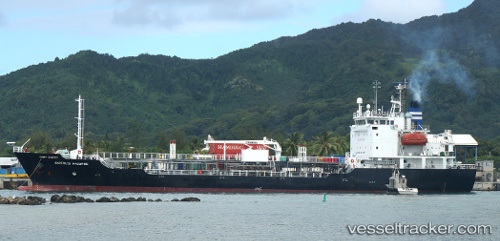
Vessel profile: MALY is a Oil/Chemical Tanker with dimensions m x m.
This page combines live AIS, route history, probable destination signals, nearby traffic, and port activity for practical vessel monitoring.
The current position of vessel MALY is 35.08425 lat / 129.00494 lng. Updated: 2026-05-20 17:05:24 UTCNearest reference points:
- Near Gamcheon/Busan
- Near Busan
- Near BUSAN NEW PORT
Currently sailing under the flag of South Korea ![]()
Details:
Live Vessel MALY Analytics (details, animations, etc.)
Recent AIS points (UTC):
2026-05-20 13:21:24 UTC · 35.08430, 129.00502 · SOG 0 kn · COG 191°2026-05-20 14:03:24 UTC · 35.08428, 129.00508 · SOG 0 kn · COG 191°
2026-05-20 15:47:26 UTC · 35.08430, 129.00500 · SOG 0 kn · COG 191°
2026-05-20 17:05:24 UTC · 35.08425, 129.00494 · SOG 0 kn · COG 191°