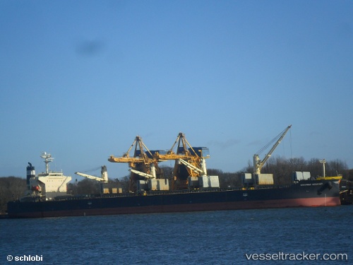
.
Vessel photo of Daidan Pertiwi (IMO 9302798) vesseltracker.com

Daidan Pertiwi

Vessel type: Bulk Carrier | IMO: 9302798 | MMSI: MMSI: 525300129
Call sign: YCPI2 | Dimensions: 32 m x 189 m
Current Status

Where is the vessel?

Daidan Pertiwi is currently in Near Mumbai, based on AIS data received about 14h ago.

Latest AIS update:

Current position: 18.88908° N, 72.84487° E (Near Mumbai)

Average speed (last 7 days): Loading…

Average speed (last 30 days): Loading…

Vessel profile: Daidan Pertiwi is a Bulk Carrier with dimensions 32m x 189m.

This page combines live AIS, route history, probable destination signals, nearby traffic, and port activity for practical vessel monitoring.

The current position of vessel Daidan Pertiwi is 18.88908 lat / 72.84487 lng. Updated: 2026-05-18 09:24:12 UTC
More recent position available: 1 h 24 min ago
Free positions are delayed by 14 hours.

We recommend registering. If you register, paid vessel access will be saved in your profile. Guest access works only through a personal link.

Nearest reference points:
  • Near Mumbai
  • Near HNB SEZ/Mumbai
  • Near NHAVA SHEVA
Details:

Live Vessel Daidan Pertiwi Analytics (details, animations, etc.)


Recent AIS points (UTC):
2026-05-18 06:06:12 UTC · 18.89230, 72.84715 · SOG 0.1 kn · COG 217°
2026-05-18 08:00:14 UTC · 18.89120, 72.84797 · SOG 0.2 kn · COG 258°
2026-05-18 08:03:13 UTC · 18.89103, 72.84800 · SOG 0.1 kn · COG 262°
2026-05-18 09:24:12 UTC · 18.88908, 72.84487 · SOG 0 kn · COG 13°

UTC: --
Start: -- Track timeline (UTC) End: --
Encountered: --


Link to the map:


Find another ship

Daidan_Pertiwi (525300129) last ports (portcalls and passsages)

Bayah | 2025-09-15 13:22:46
GRESIK | 2025-08-22 16:54:47
GRESIK | 2025-08-18 16:22:09
GRESIK | 2025-08-14 15:25:27
SURALAYA | 2025-08-12 13:05:57
BAKAUHENI | 2025-08-12 11:03:28
BYAH | 2025-08-09 17:54:20
CIWANDAN | 2025-08-09 02:40:45
MERAK | 2025-08-09 01:45:17
SURALAYA | 2025-08-08 01:33:07
Taboneo | 2025-08-02 17:22:48
Makassar | 2025-07-31 23:17:14
Makassar | 2025-06-24 03:01:20
Muara Pantai | 2025-05-13 12:05:58
Muara Pantai | 2025-05-09 11:01:34
KABIL | 2025-03-14 16:47:02
Senipah Oil Terminal | 2024-12-10 07:46:06
Senipah Oil Terminal | 2024-12-06 07:02:31
Senipah Oil Terminal | 2024-12-02 05:30:07
KABIL | 2024-11-26 20:21:12
TANJUNGUBAN | 2024-11-26 19:12:30
KABIL | 2024-11-22 20:02:09
TANJUNGUBAN | 2024-11-22 18:29:16
KABIL | 2024-11-18 19:21:51
TANJUNGUBAN | 2024-11-18 18:12:42
Panjang | 2024-11-16 00:27:17
Panjang | 2024-11-11 11:25:06
Selat Sunda | 2024-11-11 07:22:31
MERAK | 2024-11-11 06:02:40
SURALAYA | 2024-11-08 13:51:41
Selat Sunda | 2024-09-27 17:59:37
Panjang | 2024-09-27 13:25:35
Panjang | 2024-09-19 18:07:54
Tandjung Uban | 2024-09-16 12:47:08
Tandjung Uban | 2024-09-12 12:43:33
Sambu | 2024-09-12 09:25:19
Singapore | 2024-07-29 18:23:10
Singapore | 2024-07-17 15:06:45
Panamburu | 2024-07-08 02:10:51
Tuticorin | 2024-07-03 12:04:14
Sebang | 2024-06-19 12:49:26
Singapore | 2024-06-17 03:42:28
Sambu | 2024-06-17 03:09:25
Senipah Oil Terminal | 2024-04-26 02:46:36
Senipah Oil Terminal | 2024-04-22 01:59:49
Muara Pantai | 2024-04-01 01:15:25
Muara Pantai | 2024-03-27 22:35:11
Selat Sunda | 2023-10-30 16:46:52
Tandjung Uban | 2023-10-23 07:04:55
Tandjung Uban | 2023-10-19 06:10:51
Tandjung Uban | 2023-10-15 04:49:57
Tandjung Uban | 2023-10-11 04:45:34
Selat Sunda | 2023-09-30 07:50:56
Selat Sunda | 2023-09-23 08:26:39
Muara Pantai | 2023-09-04 10:05:19
Muara Pantai | 2023-08-31 09:18:02
Sambu | 2023-02-23 17:16:25
Sambu | 2023-02-19 17:02:40
Sambu | 2023-02-15 09:01:07
Sambu | 2023-02-11 08:41:35
Sambu | 2023-02-07 05:52:01