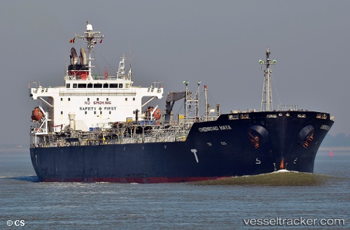
Chemroad Haya
Current StatusWhere is the vessel?
Chemroad Haya is currently in 360 nm S of St. Helena Island, based on AIS data received about 14h ago.
Latest AIS update:
Current position: 21.67942° S, 7.48778° W (360 nm S of St. Helena Island)
Average speed (last 7 days): Loading…
Average speed (last 30 days): Loading…
Vessel profile: Chemroad Haya is a Chemical Oil Products Tanker with dimensions 29m x 175m.
This page combines live AIS, route history, probable destination signals, nearby traffic, and port activity for practical vessel monitoring.
The current position of vessel Chemroad Haya is -21.67942 lat / -7.48778 lng. Updated: 2026-05-21 17:54:21 UTCNearest reference points:
- Open sea, approx. 400 nm off the nearest listed port
- Open sea, approx. 401 nm off the nearest listed port
- Open sea, approx. 402 nm off the nearest listed port
Details:
Live Vessel Chemroad Haya Analytics (details, animations, etc.)
Recent AIS points (UTC):
2026-05-21 13:33:31 UTC · -22.20198, -6.53568 · SOG 14 kn · COG 301°2026-05-21 16:23:30 UTC · -21.85976, -7.15763 · SOG 14.1 kn · COG 301°
2026-05-21 17:02:14 UTC · -21.78601, -7.30055 · SOG 14.1 kn · COG 303°
2026-05-21 17:54:21 UTC · -21.67942, -7.48778 · SOG 14.4 kn · COG 303°