 vesseltracker.com
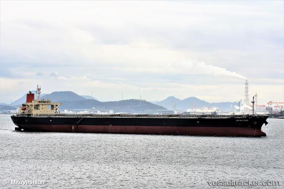
 SEMA M
Current Status
Where is the vessel?
SEMA M is currently in 46 nm NE of PENGERANG, based on AIS data received about 14h ago.
Latest AIS update:
Current position: 1.82882° N, 104.73999° E (46 nm NE of PENGERANG)
Average speed (last 7 days): Loading…
Average speed (last 30 days): Loading…
Vessel profile: SEMA M is a Bulk Carrier with dimensions 43m x 255m.
This page combines live AIS, route history, probable destination signals, nearby traffic, and port activity for practical vessel monitoring.
The current position of vessel SEMA M is 1.82882 lat / 104.73999 lng. Updated: 2026-05-17 21:49:50 UTCNearest reference points:
- 45 nm NE of PENGERANG
- 51 nm NE of PENGERANG
- 53 nm NE of PENGERANG
Currently sailing under the flag of Liberia ![]()
SEMA M built in 2007 year
Deadweight:
106552 tDetails:
Live Vessel SEMA M Analytics (details, animations, etc.)
Recent AIS points (UTC):
2026-05-17 18:40:55 UTC · 1.82824, 104.74205 · SOG 0.1 kn · COG 221°2026-05-17 19:25:53 UTC · 1.82845, 104.74174 · SOG 0 kn · COG 211°
2026-05-17 21:49:50 UTC · 1.82882, 104.73999 · SOG 0 kn · COG 172°
2026-05-17 21:49:50 UTC · 1.82882, 104.73999 · SOG 0 kn · COG 172°