 SKIPPER
Current Status
Where is the vessel?
SKIPPER is currently in 39 nm SE of Quintana, based on AIS data received about 14h ago.
Latest AIS update:
Current position: 28.59167° N, 94.65333° W (39 nm SE of Quintana)
Average speed (last 7 days): Loading…
Average speed (last 30 days): Loading…
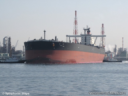
Vessel profile: SKIPPER is a Crude Oil Tanker with dimensions 333m x 60m.
This page combines live AIS, route history, probable destination signals, nearby traffic, and port activity for practical vessel monitoring.
The current position of vessel SKIPPER is 28.59167 lat / -94.65333 lng. Updated: 2026-05-21 21:20:02 UTCNearest reference points:
- 39 nm S of Sheppard
- 43 nm SE of Sheppard
- 49 nm SE of Sheppard
Currently sailing under the flag of Guyana ![]()
SKIPPER built in 2005 year
Deadweight:
310309 tDetails:
Live Vessel SKIPPER Analytics (details, animations, etc.)
Recent AIS points (UTC):
2026-05-21 18:10:49 UTC · 28.58897, -94.65672 · SOG 0.1 kn · COG -1°2026-05-21 19:31:55 UTC · 28.59067, -94.65615 · SOG 0.1 kn · COG -1°
2026-05-21 20:02:04 UTC · 28.59167, -94.65333 · SOG 0 kn · COG -1°
2026-05-21 21:20:02 UTC · 28.59167, -94.65333 · SOG 0 kn · COG -1°